Today, space is experiencing a revolution: from large space agencies, multimillion dollar budgets, and big satellite missions to spin-off companies, moderate budgets, and fleets of small satellites. Some have called this the “democratization” of space, in the sense that it is now more accessible than it was just a few years ago. To a large extent, this revolution has been fostered on one side by the standardization of the platforms’ mechanical interfaces, and on the other side by the technology developments coming from mobile communications. Standard platform’s mechanical interfaces have led to standard orbital deployers, and new launching capabilities. The technology developed for cell phones has brought more computing resources, with less power consumption and volume.
Small satellites are used as pure technology demonstrators, for targeted scientific missions, mostly Earth Observation, and they are starting to enter in the field of communications, as huge satellite constellations are now becoming more possible.
In this short course, the most widely used nano/microsats form factors, and its main applications will be first introduced, as well as the nanosat program at the Universitat Politècnica de Catalunya (UPC). Taking UPC 3Cat-4 mission as an example, the different subsystems will be described and the design constraints will be presented, as well as their interactions. These include:
Finally, the main Earth Observation techniques will be briefly presented, and those suitable for small satellites will be presented in more detail.
Students will be provided with a basic set of slides, suitable for the 3.5 h course, and a more advanced one plus a simple software toold to conduct simple mission analysis for those interested in a deeper understanding of this field.

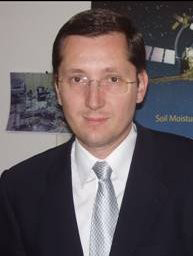
Adriano Camps was born in Barcelona, Spain, in 1969. In 1993 he joined the Electromagnetics and Photonics Engineering Group, Department of Signal Theory and Communications, Universitat Polittècnica de catalunya (UPC), as an Assistant Professor, Associate Professor in 1997, and Full Professor since 2007. In 1999, he was on sabbatical leave at the Microwave Remote Sensing Laboratory, of the University of Massachusetts, Amherst. His research interests are focused in microwave remote sensing, with special emphasis in microwave radiometry by aperture synthesis techniques (MIRAS instrument onboard ESA’s SMOS mission), remote sensing using signals of opportunity (GNSS-R), and nanosatellites as a tool to test innovative remote sensors. He has published over 194 papers in peer-reviewed journals, 6 book chapters and 1 book (860 pages), and more than 410 conference presentations, holds 10 patents, and has advised 22 Ph. D. Thesis students (+ 9 on-going), and more than 125 final project and M.Eng. Theses.
Hyperspectral remote sensing has found application across many traditional earth observation applications including agriculture, forestry, mining, and water quality. Hyperspectral sensors image the earth with high spatial resolution in hundreds of narrow, contiguous, co-registered spectral bands. Also known as imaging spectrometry, the field began in the 1980’s with airborne sensors and continues today with small sensors mounted on unmanned aerial vehicles (UAVs), as well as emerging capabilities from satellites.
This tutorial will cover this topic in three sections.

John Kerekes received the B.S., M.S., and Ph.D. degrees from Purdue University, West Lafayette, IN, USA, all in electrical engineering. From 1989 to 2004, he was a Technical Staff Member with the Lincoln Laboratory, Massachusetts Institute of Technology, Lexington, MA, USA. Since 2004, he has been with the Chester F. Carlson Center for Imaging Science, Rochester Institute of Technology, Rochester, NY, USA, where he is currently a full Professor. From September 2016 through May 2019 he served as the Director of the Digital Imaging and Remote Sensing Laboratory (DIRS) at RIT. Dr. Kerekes is a Senior Member of IEEE, OSA, and SPIE, and a member of AGU and ASPRS. He served as the founding Chair of the Boston and the Western New York Chapters of the IEEE Geoscience and Remote Sensing Society (GRSS). He was Co-General Chair of the 2008 IEEE International Geoscience and Remote Sensing Symposium (IGARSS’08) held in Boston, MA, USA. From 2010 to 2015 he was a member of the GRSS Administrative Committee (AdCom) including service as the Vice President of Technical Activities from 2011 to 2015. In January 2017 he was appointed Chief Financial Officer of the GRSS. His research interests include the modeling and analysis of remote sensing system performance in pattern recognition and geophysical parameter retrieval applications. He has over 175 scientific publications.
Every day a large number of Earth observation (EO) space borne and airborne sensors from many different countries provide a massive amount of remotely-sensed data. Those data sets comprise different spectral bandwidths (dimensionality), spatial resolutions, and radiometric resolutions. Combined with human activities and data from social science, the massive remotely sensed data (which consists of big data in remote sensing) have been successfully used for different applications, such as natural hazard monitoring, global climate change, urban planning, etc. Current estimates say that remotely sensed data are now being collected following a Petabyte level growth per day over the world. This makes the remote sensing data an ideal candidate for Big data applications due to its sheer volume, varieties in terms of temporal, spatial and spectral resolution, continuous collection of data (velocity) and necessity of ground validation (veracity). Most of the remotely sensed big data analyses do not make any sense if they lag in time. Hence, the value of the data is too short lived and holds purpose only if used in proper time.
Despite the advancements in the broad field of computer science, storing, managing, processing and mining this remotely sensed “big” data is still a significant challenge. Currently, data analysis methods play a central role in geosciences and remote sensing. While gathering large collections of data is essential in the field, analyzing this information becomes more challenging. Evidently, such “Big Data” has notable effects both on the predictive analytics and the knowledge extraction and interpretation tools. Considering the significant capabilities of machine learning, it seems to be a very efficacious approach to handle this type of information.
Machine learning creates a platform which helps to extract, understand and learn the underlying structure of this data. There have been many efforts to modify or adapt machine learning methods for this specific purpose. They have been made scalable and real time. Machine Learning focuses on the automatically extraction of information from data by computational and statistical methods. The application areas are very diverse and include different themes such as trace gases, aerosol products, vegetation indices, ocean products, characterization of rock mass, liquefaction phenomenon, ground motion parameters, interpreting the remote sensing image, etc.
This will be a three part talk. It will start with the motivation and basics of machine learning methods, and recent developments. We will cover the fundamentals and look at the best practices, common architectures and popular frameworks. The second part of the talk will focus on some interesting theoretical problems in remote sensing applications that can be solved by machine learning methods. The last part of the talk will focus on applied aspects and current topics in Big Data analytics for remotely sensed data. We will touch upon some popular initiatives and comment on the future of the remotely sensed big data analytics. The lecture will show a gradual adaptation from basic machine learning techniques to the advanced techniques used for remotely sensed big data analytics. Several interesting topics like climate informatics, automatic object detection, change detection etc. will be given special emphasis.

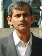
Starting as an electronic engineer (1983-'87), Prof. Ghosh moved to computer science during his master's (1987-'89), and finally to Intelligence (AI) during PhD (1993). Completing post-doctoral research in Japan (1995-'96), he joined as a faculty member at ISI (professor, and contributing immensely to the field of AI, machine learning, image/video analysis and data science. He has already published 250 research articles on these subjects; and has an H-index 40.
For his pioneering contribution in computational intelligence and image analysis, he earned Young Scientist award from Indian Science Congress (1992), Young Scientist Medal from INSA (1995), and Young Associateship of Indian Academy of Sciences (1997). He is a Fellow of the West Bengal Academy of Science and Technology. For his excellent service to IEEE, he received IEEE-GRSS Regional Leader Award, 2019.
He visited various Universities/Academic Institutes in connection with conducting collaborative research/projects and deliver lectures in different countries including China, Germany, Hong Kong, Italy, Japan, Poland, Portugal, South Korea, Thailand, The Netherlands and the USA.
He served as plenary/keynote speakers in many international conferences in India and abroad. To upgrade and nurture the engineering community, he disseminated seminar lectures and conducted several workshops /short-term courses in different parts of India on upcoming topics of AI, machine learning, image & video analysis and data science. As PI and Co-PI, he completed seventeen projects of national and international importance, funded by Government of India, European Commission, Indo-Italy and Indo-US forum for science & technology.
He is a member of the founding team that established the National Center for Soft Computing Research at the Indian Statistical Institute, Kolkata in 2004 with funding from the Department of Science and Technology, Govt. of India. Since 2010, he is acting as the In-charge of this Center that has been recognized as an Associate Institute of ISI. He also served as the Head of the well-known Machine Intelligence Unit of ISI during 2013-2014.
He is currently leading the Data Science Research consortium project as the Theme Coordinator to manage a number of projects assigned to different reputed Indian Institutes under ICPS program of DST. He is an Associate Editor of several International journals, like, IET Journal of Computer Vision, CAAI Transactions on Intelligence Technology (published from IET) and Sadhana, and a Series Editor of Communications in Computer and Information Science (CCIS), Springer-Nature.